


LES CLUSES 66

jeff66
User

Length
9.4 km

Max alt
319 m

Uphill gradient
257 m
Km-Effort
12.8 km

Min alt
139 m

Downhill gradient
260 m
Boucle
Yes
Creation date :
2015-05-21 00:00:00.0
Updated on :
2015-05-21 00:00:00.0
1h50
Difficulty : Easy

FREE GPS app for hiking
 SityTrail
IGN / Geographical institutes
SityTrail Plus
The world is yours!
About
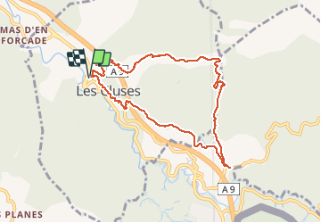
Trail Walking of 9.4 km to be discovered at Occitania, Pyrénées-Orientales, Les Cluses. This trail is proposed by jeff66.
Positioning
Country:
France
Region :
Occitania
Department/Province :
Pyrénées-Orientales
Municipality :
Les Cluses
Location:
Unknown
Start:(Dec)
Start:(UTM)
486630 ; 4703729 (31T) N.
Comments
Belle balade. Merci